

Democratic Republic of the Congo, Kinshasa - national flag pinned on political map - 3D illustration
Коллекция по умолчанию
Коллекция по умолчанию
Создать новую

Geographical map location of country Republic of Congo in Africa continent on atlas
Коллекция по умолчанию
Коллекция по умолчанию
Создать новую

Democratic Republic of Congo on bright political globe with embedded flag. 3D illustration.
Коллекция по умолчанию
Коллекция по умолчанию
Создать новую

Map and flag of Tanzania on weathered concrete
Коллекция по умолчанию
Коллекция по умолчанию
Создать новую

Shape of Venezuela with its capital isolated on a solid color background. Satellite imagery. 3D rendering
Коллекция по умолчанию
Коллекция по умолчанию
Создать новую

congolese border country shape and flag with minimalist leopard and famous . rich and colorful and flat design create with old-fashioned vibe. poster for cover, banner and ads
Коллекция по умолчанию
Коллекция по умолчанию
Создать новую

Space orbit view of Burkina Faso highlighted in red on planet Earth at night with visible country borders and city lights. 3D illustration.
Коллекция по умолчанию
Коллекция по умолчанию
Создать новую

Ryazan, Russia - July 08, 2018: Country of Democratic Republic of the Congo on the google maps service
Коллекция по умолчанию
Коллекция по умолчанию
Создать новую

Democratic Republic of Congo on political globe with embedded flags. 3D illustration isolated on white background.
Коллекция по умолчанию
Коллекция по умолчанию
Создать новую

Portrait of a cute little African girl holding a sign with the word DRC Congo
Коллекция по умолчанию
Коллекция по умолчанию
Создать новую

Orbit view of Guinea highlighted in red with visible borderlines and city lights on planet Earth at night. 3D illustration.
Коллекция по умолчанию
Коллекция по умолчанию
Создать новую

South Sudan in early morning light highlighted in red on planet Earth. 3D illustration.
Коллекция по умолчанию
Коллекция по умолчанию
Создать новую

Republic of the Congo map on a world map with flag and map pointer. Vector illustration
Коллекция по умолчанию
Коллекция по умолчанию
Создать новую

Outline map of Democratic Republic of Congo with flag and grunge paper effect
Коллекция по умолчанию
Коллекция по умолчанию
Создать новую

Burkina Faso area enlarged and glowed on a darkened background of its surroundings. Satellite imagery
Коллекция по умолчанию
Коллекция по умолчанию
Создать новую

Congo from space on Earth at night. Very fine detail of the plastic planet surface with bright city lights. 3D illustration.
Коллекция по умолчанию
Коллекция по умолчанию
Создать новую

Flags of Tanzania and China on cracked surface - politics, relationship concept
Коллекция по умолчанию
Коллекция по умолчанию
Создать новую

Red marker over Guyana
Коллекция по умолчанию
Коллекция по умолчанию
Создать новую

Sunrise above Uruguay highlighted in red on model of planet Earth in space with visible country borders. 3D illustration.
Коллекция по умолчанию
Коллекция по умолчанию
Создать новую

Republic of the Congo, Brazzaville - capital city, pinned on political map
Коллекция по умолчанию
Коллекция по умолчанию
Создать новую

Gabon in early morning light highlighted in red on planet Earth. 3D illustration.
Коллекция по умолчанию
Коллекция по умолчанию
Создать новую

Satellite morning view of Central Africa highlighted in red on planet Earth with visible border lines and city lights. 3D illustration.
Коллекция по умолчанию
Коллекция по умолчанию
Создать новую

Extended area of Gabon with country outline, international and regional borders. Satellite imagery. 3D rendering
Коллекция по умолчанию
Коллекция по умолчанию
Создать новую

very big size congo republic political map with flag
Коллекция по умолчанию
Коллекция по умолчанию
Создать новую

Dem Rep of Congo from space on Earth at night. Very fine detail of the plastic planet surface with bright city lights. 3D illustration.
Коллекция по умолчанию
Коллекция по умолчанию
Создать новую

Uganda from space on model of planet Earth with country borders. Extremely fine detail of planet surface and clouds. 3D illustration.
Коллекция по умолчанию
Коллекция по умолчанию
Создать новую

Top-down view of South Sudan hightlighted in red as seen from Earth's orbit in space. 3D illustration with highly detailed realistic planet surface. Elements of this image furnished by NASA.
Коллекция по умолчанию
Коллекция по умолчанию
Создать новую

Detailed map of Republic of the Congo and capital city Brazzaville with flag on black background
Коллекция по умолчанию
Коллекция по умолчанию
Создать новую

Orbit view of Central Africa highlighted in red on planet Earth with highly detailed surface textures. 3D illustration.
Коллекция по умолчанию
Коллекция по умолчанию
Создать новую

Burkina Faso from orbit of planet Earth in sunrise with highly detailed surface textures and visible country borders. 3D illustration.
Коллекция по умолчанию
Коллекция по умолчанию
Создать новую

Democratic Republic of the Congo flag map.Map of Democratic Republic of the Congo with an official flag. Illustration on white background
Коллекция по умолчанию
Коллекция по умолчанию
Создать новую

Togo in red on planet Earth with visible borderlines. 3D illustration.
Коллекция по умолчанию
Коллекция по умолчанию
Создать новую

Hand marking Paris on map with red pin
Коллекция по умолчанию
Коллекция по умолчанию
Создать новую

Kenya highlighted in red from Earth’s orbit at night with visible country borders. 3D illustration.
Коллекция по умолчанию
Коллекция по умолчанию
Создать новую

Horn of Africa from space on realistic model of planet Earth with country borders and detailed planet surface and clouds. 3D illustration.
Коллекция по умолчанию
Коллекция по умолчанию
Создать новую

Shape of Savanes, region of Togo, with its capital isolated on a solid color background. Satellite imagery. 3D rendering
Коллекция по умолчанию
Коллекция по умолчанию
Создать новую

Uganda on realistic model of planet Earth with country borders and very detailed planet surface and clouds. 3D illustration.
Коллекция по умолчанию
Коллекция по умолчанию
Создать новую

Democratic Republic of Congo in the morning highlighted in red on planet Earth with visible border lines and city lights. 3D illustration.
Коллекция по умолчанию
Коллекция по умолчанию
Создать новую

Malawi during sunrise highlighted in red on planet Earth with visible country borders. 3D illustration.
Коллекция по умолчанию
Коллекция по умолчанию
Создать новую

Africa. Coronavirus COVID-19 global cases Map. Red Dot showing the number of infected. Johns Hopkins University map on monitor display.
Коллекция по умолчанию
Коллекция по умолчанию
Создать новую

DEMOCRATIC REPUBLIC OF THE CONGO map vector design template
Коллекция по умолчанию
Коллекция по умолчанию
Создать новую

Nigeria highlighted in red on physical map. 3D illustration.
Коллекция по умолчанию
Коллекция по умолчанию
Создать новую

Congo Republic road sign against clear blue sky
Коллекция по умолчанию
Коллекция по умолчанию
Создать новую

East of England, region of United Kingdom. Colored relief with lakes and rivers. Shape outlined against its country area. 3D rendering
Коллекция по умолчанию
Коллекция по умолчанию
Создать новую

Orbit view of Gabon highlighted in red with visible borderlines and city lights on planet Earth at night. 3D illustration
Коллекция по умолчанию
Коллекция по умолчанию
Создать новую

puzzle with the national flag of bulgaria and tanzania on a world map background. 3D illustration
Коллекция по умолчанию
Коллекция по умолчанию
Создать новую

Satellite night view of Congo highlighted in red on planet Earth. 3D illustration.
Коллекция по умолчанию
Коллекция по умолчанию
Создать новую

Rwanda from space with highly detailed surface textures and visible country borders. 3D illustration.
Коллекция по умолчанию
Коллекция по умолчанию
Создать новую

Angolan flag with a globe map as a background macro
Коллекция по умолчанию
Коллекция по умолчанию
Создать новую

Map of Central African Rep. Shows country borders, urban areas, place names and roads. Labels in English where possible.
Коллекция по умолчанию
Коллекция по умолчанию
Создать новую

Evening over Togo as seen from space on planet Earth with visible border lines and city lights. 3D illustration.
Коллекция по умолчанию
Коллекция по умолчанию
Создать новую

Horn of Africa from space with country borders and trajectories representing global communication, travel, connections. 3D illustration.
Коллекция по умолчанию
Коллекция по умолчанию
Создать новую

Shape of Gabon separated by the desaturation of neighboring areas. Borders. Colored elevation map. 3D rendering
Коллекция по умолчанию
Коллекция по умолчанию
Создать новую

Swaziland in red on planet Earth at night with visible borderlines and city lights. 3D illustration.
Коллекция по умолчанию
Коллекция по умолчанию
Создать новую

Granma, province of Cuba. Colored elevation map with lakes and rivers
Коллекция по умолчанию
Коллекция по умолчанию
Создать новую

Burkina Faso with national flag on blue political 3D globe. 3D illustration.
Коллекция по умолчанию
Коллекция по умолчанию
Создать новую

Cameroon - cracked country flag
Коллекция по умолчанию
Коллекция по умолчанию
Создать новую

Dem Rep of Congo with national flag on simple blue political globe. 3D illustration.
Коллекция по умолчанию
Коллекция по умолчанию
Создать новую

Close up grungy, damaged and weathered Tanzania flag on wall peeling off paint to see inside surface.
Коллекция по умолчанию
Коллекция по умолчанию
Создать новую

Rwanda in red on realistic map with embossed countries. 3D illustration.
Коллекция по умолчанию
Коллекция по умолчанию
Создать новую

Dem Rep of Congo on realistic model of planet Earth with country borders and very detailed planet surface. 3D illustration.
Коллекция по умолчанию
Коллекция по умолчанию
Создать новую

Space orbit view of Ghana highlighted in red on planet Earth at night with visible country borders and city lights. 3D illustration.
Коллекция по умолчанию
Коллекция по умолчанию
Создать новую

puzzle with the national flag of germany and togo on a world map background. 3D illustration
Коллекция по умолчанию
Коллекция по умолчанию
Создать новую

Burkina Faso from space on model of planet Earth with country borders and very detailed planet surface. 3D illustration.
Коллекция по умолчанию
Коллекция по умолчанию
Создать новую

Macro of Poland on a globe, narrow depth of field
Коллекция по умолчанию
Коллекция по умолчанию
Создать новую

Equatorial Guinea from space on model of planet Earth with country borders and very detailed planet surface. 3D illustration.
Коллекция по умолчанию
Коллекция по умолчанию
Создать новую

Uganda from space on Earth at night. Very fine detail of the plastic planet surface with bright city lights. 3D illustration.
Коллекция по умолчанию
Коллекция по умолчанию
Создать новую

Bangladesh during sunset highlighted in red on planet Earth with visible country borders. 3D illustration.
Коллекция по умолчанию
Коллекция по умолчанию
Создать новую

Democratic Republic of Congo in red on realistic map with embossed countries. 3D illustration.
Коллекция по умолчанию
Коллекция по умолчанию
Создать новую

Flags of Zambia and Japan on cracked surface - politics, relationship concept
Коллекция по умолчанию
Коллекция по умолчанию
Создать новую

Map of Democratic Republic of Congo with its flag on globe. 3D illustration
Коллекция по умолчанию
Коллекция по умолчанию
Создать новую

Map of Gabon in red as seen from space on planet Earth at night with white borderlines and city lights. 3D illustration.
Коллекция по умолчанию
Коллекция по умолчанию
Создать новую

Satellite view of Benin highlighted in red on planet Earth at night with borderlines and city lights. 3D illustration.
Коллекция по умолчанию
Коллекция по умолчанию
Создать новую

Boundaries of Parana State - mideast Brazil
Коллекция по умолчанию
Коллекция по умолчанию
Создать новую
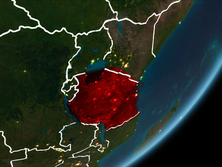
Tanzania as seen from Earth’s orbit on planet Earth at night highlighted in red with visible borders and city lights. 3D illustration.
Коллекция по умолчанию
Коллекция по умолчанию
Создать новую

Gabon on digital map with networks. Concept of international travel, communication and technology. 3D illustration.
Коллекция по умолчанию
Коллекция по умолчанию
Создать новую

aerial view of the morogoro town
Коллекция по умолчанию
Коллекция по умолчанию
Создать новую

waving colorful national flag of democratic republic of the congo on a gray map background. 3D illustration
Коллекция по умолчанию
Коллекция по умолчанию
Создать новую

Satellite view of Benin on Earth with city lights. Extremely detailed plastic planet surface with real mountains. 3D illustration.
Коллекция по умолчанию
Коллекция по умолчанию
Создать новую

Republic of Burundi location on Africa map
Коллекция по умолчанию
Коллекция по умолчанию
Создать новую

Flags of Tanzania and Poland on cracked surface - politics, relationship concept
Коллекция по умолчанию
Коллекция по умолчанию
Создать новую

Map of Guinea in red as seen from space on planet Earth at night with white borderlines and city lights. 3D illustration.
Коллекция по умолчанию
Коллекция по умолчанию
Создать новую

Map of Lithuania with embedded flag on planet surface. 3D illustration.
Коллекция по умолчанию
Коллекция по умолчанию
Создать новую

Cameroon from space on Earth at night. Very fine detail of the plastic planet surface with bright city lights. 3D illustration.
Коллекция по умолчанию
Коллекция по умолчанию
Создать новую

Map of Gabon in red as seen from space on planet Earth at night with white borderlines and city lights. 3D illustration.
Коллекция по умолчанию
Коллекция по умолчанию
Создать новую

Map illustration of DR Congo with the flag. Cartographic illustration of DR Congo and neighboring countries. Vector map and flag.
Коллекция по умолчанию
Коллекция по умолчанию
Создать новую

Eastern, province of Sierra Leone. High resolution satellite maps. Locations and names of major cities of the region. Corner auxiliary location maps
Коллекция по умолчанию
Коллекция по умолчанию
Создать новую

Shape of Central African Republic separated by the desaturation of neighboring areas. Borders. Colored elevation map. 3D rendering
Коллекция по умолчанию
Коллекция по умолчанию
Создать новую

Tanzania Metallic flag, Textured flag, grunge flag
Коллекция по умолчанию
Коллекция по умолчанию
Создать новую

Africa with highlighted Central African Republic map. Vector Illustration.
Коллекция по умолчанию
Коллекция по умолчанию
Создать новую

Illustration of Niger as seen from Earth’s orbit in late evening with visible border lines and city lights. 3D illustration.
Коллекция по умолчанию
Коллекция по умолчанию
Создать новую

Dem Rep of Congo with national flag on simple globe. 3D illustration.
Коллекция по умолчанию
Коллекция по умолчанию
Создать новую

Map of Cameroon with embedded flag on planet surface. 3D illustration.
Коллекция по умолчанию
Коллекция по умолчанию
Создать новую

Rwanda with national flag on blue political 3D globe. 3D illustration.
Коллекция по умолчанию
Коллекция по умолчанию
Создать новую

Tunisia from space on planet Earth at night with visible country borders. 3D illustration.
Коллекция по умолчанию
Коллекция по умолчанию
Создать новую

Top-down view of Nigeria hightlighted in red as seen from Earth's orbit in space. 3D illustration with highly detailed realistic planet surface.
Коллекция по умолчанию
Коллекция по умолчанию
Создать новую

African Continent Icon Map Vector
Коллекция по умолчанию
Коллекция по умолчанию
Создать новую

Space orbit view of Guinea highlighted in red on planet Earth at night with visible country borders and city lights. 3D illustration.
Коллекция по умолчанию
Коллекция по умолчанию
Создать новую

Democratic Republic of Congo on bright political globe with embedded flag. 3D illustration.
Коллекция по умолчанию
Коллекция по умолчанию
Создать новую

Satellite morning view of Central Africa highlighted in red on planet Earth. 3D illustration.
Коллекция по умолчанию
Коллекция по умолчанию
Создать новую
Legion-Media
Создайте свои проекты на основе качественных стоковых фотографий и видео.


Copyright © Legion-Media.